

Just in time for autumn, these new — and newly reopened — western N.C. hiking trails are open for discovery.
by Michael J. Solender
For city dwellers craving crisp fall air and autumn’s Appalachian color, western North Carolina has a clear message: “Lace up your hiking boots!”
A year after the devastation of Hurricane Helene, explorers will find new trails alongside tried-and-true treks. From Hendersonville and Saluda to Carvers Gap and Roan Mountain, restored favorites and new amenities remind us why western N.C.’s outdoor splendor is unlike any other.
Here are several new and recently reopened trails and recreation areas to check out:
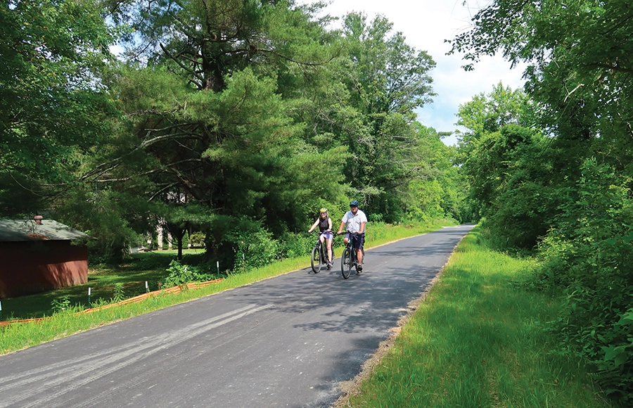
Ecusta Trail. Photograph courtesy Visit Hendersonville
Ecusta Trail
Henderson County
Few new greenway projects have generated as much enthusiasm as the Ecusta Trail, the multi-use 19.4-mile greenway connecting Hendersonville and Brevard. Ecusta, a Cherokee term meaning rippling waters, is an apt moniker as the trail is being developed alongside the French Broad and Davidson rivers. Much of the route repurposes a dormant railroad line that served the former Ecusta Paper Mill, once a major employer in the region.
Earlier this summer, the initial 6-mile stretch opened with great fanfare — the remaining 5 miles in Henderson County and 8 miles in Transylvania County are expected to be finished by late 2027.
The trailhead begins at the newly revamped Hendersonville Welcome Center, winds through town and heads west to the community of Horse Shoe. Along the paved rails-to-trails path, hikers can use a free mobile trail pass to check in at participating retailers and restaurants and earn points toward prizes that can be redeemed at the welcome center. visithendersonvillenc.org/ecusta-trail
Bell Park
Saluda
This new park and adjoining trails opened last fall in partnership with Conserving Carolina, a regional land trust dedicated to protecting natural areas in western North Carolina and upstate South Carolina.
The Henderson County park sits in Saluda along Spartanburg Highway (U.S. 176) on the forested slopes above the Green River Gorge. Visitors can enjoy an observation deck with a bench beside a raging waterfall and nearly 2 miles of moderate, rolling trails that are great for walking, hiking or running.
The best part? The park and trails are dog-friendly, and visitors can bring their (leashed) pals along to enjoy the outdoors. hendersoncountync.gov/recreation/page/bell-park
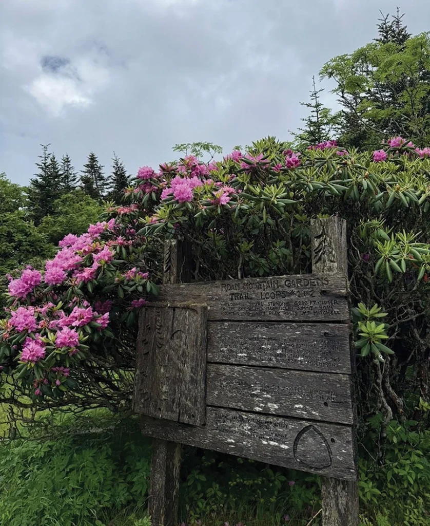
Roan Mountain Rhododendron Gardens and Curtis Creek Gateway Trail. Photographs by Stephan Pruitt Photography courtesy McDowell County and Mitchell County TDA
Cloudland Trails, Roan Mountain Rhododendron Gardens
Carvers Gap
Fall visitors revel at the Roan Mountain Rhododendron Gardens, where thousands of resplendent blooms in regal magenta and purple hues blanket the landscape. The park’s popular trails recently reopened after being closed due to hurricane damage.
“What’s truly astonishing is the beautiful views and incredible landscapes that people have enjoyed for decades remain breathtaking,” says Kelly Jones, director of the Mitchell County Tourism Development Authority. “The relief and comfort people find from their visits here are part of the true beauty of our area.”
Jones notes there are options for hikers of all levels, including the intermediate hike from Carvers Gap to Cloudland Mountain (4 miles) and a more difficult, 8-mile trek from Carvers Gap to Roan High Bluff. Many of the trails run along the ridge that is the Tennessee-North Carolina border and traverse sections of the fabled Appalachian Trail.
Trailheads are found at Roan Mountain Recreation Area, just off N.C. 261 at Carvers Gap at the end of the spur road N.C. 1348. roanmountain.com/rhododendron-gardens/
Old Fort Gateway Trails
McDowell County
This spring, 8 miles of new connections to the Old Fort Trail System opened, with 20 of 42 planned miles now open to hikers, bikers and equestrians.
The Old Fort Gateway Trails Project is a community initiative within Pisgah National Forest. The trails can be enjoyed by hikers, bikers and equestrians.
The new connectors include the 1.5-mile Catawba View Trail, a beginner’s loop with Catawba River valley views, the Deep Cove Trail, a moderate hike through rhododendron tunnels and rocky coves, the 2.5-mile Camp Rock Trail, with sweeping views of Heartbreak Ridge, the half-mile Jerdon Connector loop, and Stagecoach, a Creekside hiking route to Point Lookout Greenway.
The main trailhead is located south of Curtis Creek and has parking, restrooms and picnic tables. Additional parking is available at the Gateway Trailhead’s Meadows lot and Camp Grier’s Allison Trailhead on Mill Creek Road. g5trailcollective.org/gateway-trails
Bob Benner Memorial Trail
Burke County
South Mountains Headwaters Preserve christened this new trail earlier this year, with two overlooks offering scenic views. Benner was a founding board member of Foothills Conservancy of North Carolina and a fierce advocate for outdoor recreation and conservation.
The moderately strenuous out-and-back trail spans about 1.3 miles one way and climbs roughly 500 feet from the parking area to its highest point. Portions follow old logging roads — watch for turns where the trail leaves or joins these roads.
The South Mountains Headwaters Preserve was created in 2015 to safeguard the land and water resources of the Henry Fork and Jacob Fork River headwaters. At nearly 1,900 acres, it shares 3 miles of boundary with South Mountains State Park.
The trailhead and parking area is located on Old N.C. 18, just south of Sugarloaf Road and north of Baptist Camp Road, approximately 20 minutes from downtown Morganton. foothillsconservancy.org/trails/#bbmt SP
Featured photograph courtesy McDowell County
